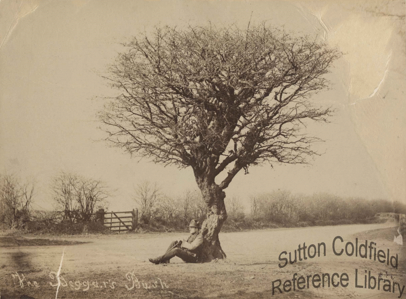
By Act of Parliament dated 1824 the surveyor John Harris was appointed to be the Commissioner for the Enclosure of the commons of Sutton Coldfield. One of his first duties was to define the boundaries of Sutton, and he did this by making a perambulation or beating of the bounds. He described the bounds in great detail in a document completed on October 5th 1824, which forms part of the Enclosure Award published when all the details of the enclosure had been completed in 1851.
Mr. Harris began his perambulation at Birmingham Road in Wylde Green near the junction with Harman Road. He cut across the corner of a Sutton field through part of an Erdington man’s garden, following an ancient boundary once recognisable by landmarks long since gone. Crossing Chester Road, the boundary then follows the edge of Erdington New Enclosures. Erdington commons had been enclosed twenty years previously - in 1800 there had been a vast area of featureless common on either side of Chester Road, and the Erdington commissioner had to determine how much of it belonged to the hamlet of Erdington. The line he drew was agreed by the Warden and Society of Sutton, but disgruntled Suttonians were still complaining in 1855 that the ancient boundary had been half a mile further south at the Hawthorn Brook.
The perambulation followed the Erdington boundary in a straight line parallel to Chester Road, crossing Gravelly Lane (then called Sandy Lane) as far as Court Lane, where it bends towards Chester Road. Harris passed a place called Jordans Grave before crossing College Road which marked the boundary between Erdington and Perry Barr; Erdington was in Warwickshire, but Perry Barr was in Staffordshire, so the parish boundary was now also the county boundary. From there “in a straight line to a certain Hawthorn Bush in the centre of the Turnpike Road leading from the Horse and Jockey to West Bromwich” (Kings Road).
Crossing to the north side of Chester Road, the boundary follows ditches and hedges a few yards to the north of the road, as far as Banners Gate, and after that a ditch between the paling of Sutton Park and the Castle Bromwich and Chester Turnpike Road. Although the road itself is not the boundary, it may have been in earlier times. A robbery took place on Chester Road in 1323, when a large sum of money was stolen from a traveller. The money was not recovered, and the courts ordered that the county in which the robbery occurred must raise the equivalent value to recompense the victim. However, the crime was committed on a road called the Ridgeway which marked the boundary between Staffordshire and Warwickshire, so the sheriffs of both counties sought to excuse themselves on the grounds of poverty. The robbery must have taken place on the stretch of the Chester Road between the Beggars Bush and Queslett Road where it formed the county boundary (the boundary was altered early in the twentieth century to include land to the south of Chester Road).
