Only a few early thirteenth century deeds relating to Sutton survive, the earliest, issued by Waleran the fourth Earl of Warwick in about 1200, concerns land at Ashfurlong, the exact location of which is uncertain. Two surviving deeds or charters of his grandson Thomas de Beaumont, the sixth earl, give more specific locations for the property concerned.
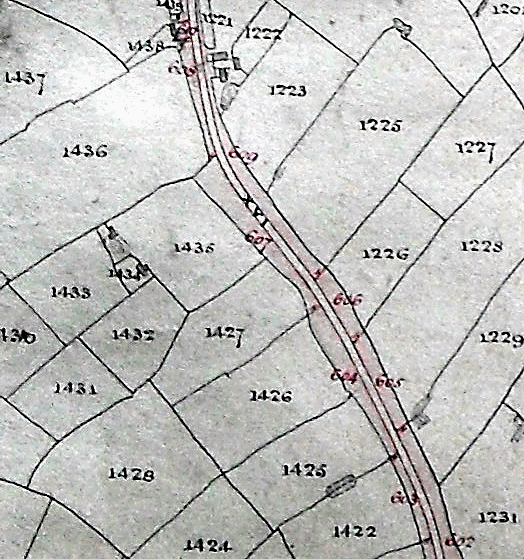
Both of these charters are grants to Walter de Bereford. One is for four acres of arable land lying “between the assart of Simon de Bereford and the assart of Adam de Berhull beside the road leading from Sutton towards Wishaw”. This road is now Bulls Lane, giving a definite location for one boundary of the land, and naming the owners of the adjacent fields on either side.
The other charter relates to twelve acres “in Sutton Woods”, six of them at “Rommeshurst” (now Ramshurst), just south of Bulls Lane “next to the land of Augustine of Wishaw and extending from the assart of Nicholas of Curdworth to the great road (i.e Bulls Lane)”. The other six acres are on the opposite side of the road, three next to land of Henry the Chaplain of Wishaw and three adjacent to land of Henry son of Osbert.
The Earl of Warwick was lord not only of the Manor of Sutton Coldfield but also of the wider area, Sutton Chase, where forest laws applied. In 1200 there was need to bring more land into cultivation to satisfy the growing population, and when new land was cleared in a forest or chase, it was called an assart. According to forest law, assarting was illegal, but was often permitted by the lord of the chase so long as a good rent was payable. Walter de Bereford agreed in both these charters to pay an annual rent of twopence an acre to Earl Thomas, but also made him a one-off gift for the privilege. He paid one silver mark (thirteen shillings and fourpence, two thirds of a pound) for the four acres and twelve marks (£8) for the twelve acres.
Earl Thomas died in 1242, so these two transactions were probably made in the 1230s; the historian Sir William Dugdale gives 1252 as the earliest mention of the De Berefords being at Langley Hall. Langley Hall, demolished c.1820, was once the grandest house in Sutton dating from the twelfth century; the moated site is now unrecognisable, occupied by the modern Langley Hall Farm off Ox Leys Road.

